Property Record
1020 W Irish St, Greeneville, TN 37743
Current Lease Availabilities
NEARBY LISTINGS FOR SALE OR LEASE
Property Detail
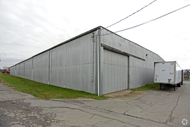
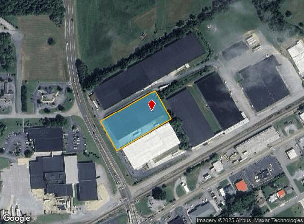
1020 W Irish St
098O-A-021.01
Azimuth Engineering
Commercialnec
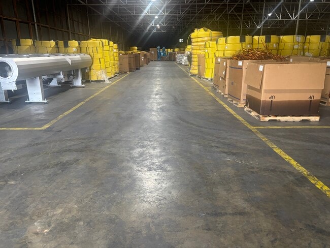
WHSE # 5 ABC WAREHOUSE
X
Greene
47059C0238D
Tennessee
0
1.95 AC
2025
Tennessee East Area
090100
Other Market Areas
50,700 SF
Greeneville, TN
DEMOGRAPHICS near 1020 W Irish St
1 Mile
3 Mile
5 Mile
2024 Total Population
3,620
17,028
28,722
2029 Population
3,833
17,975
30,285
Pop Growth 2024-2029
+ 5.88%
+ 5.56%
+ 5.44%
Average Age
42
43
43
2024 Total Households
1,577
7,145
11,993
HH Growth 2024-2029
+ 5.96%
+ 5.65%
+ 5.54%
Median Household Inc
$48,174
$55,812
$55,844
Avg Household Size
2.20
2.30
2.30
2024 Avg HH Vehicles
2.00
2.00
2.00
Median Home Value
$174,213
$174,148
$181,776
Median Year Built
1965
1970
1975
Nearby Places
- Restaurants
- Banks
- Shops
- Fitness
- Groceries
Nearby Properties
Address
Land Use
TOTAL SIZE
Lot Size
Zoning
Address
Land Use
TOTAL SIZE
Lot Size
Zoning
45,288 SF
4.78 AC
MR
Address
Land Use
TOTAL SIZE
Lot Size
Zoning
111,495 SF
9.82 AC
M2
Address
Land Use
TOTAL SIZE
Lot Size
Zoning
50,806 SF
6.14 AC
A1
Address
Land Use
TOTAL SIZE
Lot Size
Zoning
39,910 SF
5.50 AC
A1
Address
Land Use
TOTAL SIZE
Lot Size
Zoning
51,265 SF
4 AC
Address
Land Use
TOTAL SIZE
Lot Size
Zoning
70,123 SF
1.10 AC
A1
Address
Land Use
TOTAL SIZE
Lot Size
Zoning
44,415 SF
5.23 AC
A1
Address
Land Use
TOTAL SIZE
Lot Size
Zoning
11,016 SF
6.50 AC
B4
Address
Land Use
TOTAL SIZE
Lot Size
Zoning
165,500 SF
23 AC
M1
Address
Land Use
TOTAL SIZE
Lot Size
Zoning
27,117 SF
2.77 AC
A1
Address
Land Use
TOTAL SIZE
Lot Size
Zoning
5,596 SF
2.74 AC
R1
Address
Land Use
TOTAL SIZE
Lot Size
Zoning
92,764 SF
9.57 AC
A1
Address
Land Use
TOTAL SIZE
Lot Size
Zoning
42,771 SF
4.25 AC
M2
Address
Land Use
TOTAL SIZE
Lot Size
Zoning
20,820 SF
150 AC
B2
Address
Land Use
TOTAL SIZE
Lot Size
Zoning
28,122 SF
0.53 AC
B3
Address
Land Use
TOTAL SIZE
Lot Size
Zoning
130,338 SF
9.82 AC
M1
Address
Land Use
TOTAL SIZE
Lot Size
Zoning
42,552 SF
3.67 AC
B4
Address
Land Use
TOTAL SIZE
Lot Size
Zoning
110,000 SF
14.94 AC
A1
Address
Land Use
TOTAL SIZE
Lot Size
Zoning
43,575 SF
239 AC
A1
Address
Land Use
TOTAL SIZE
Lot Size
Zoning
57,563 SF
11.50 AC
B-4
Address
Land Use
TOTAL SIZE
Lot Size
Zoning
65,732 SF
10.29 AC
M1
Address
Land Use
TOTAL SIZE
Lot Size
Zoning
129,865 SF
9.07 AC
M1
Address
Land Use
TOTAL SIZE
Lot Size
Zoning
54,893 SF
9.70 AC
M1
Address
Land Use
TOTAL SIZE
Lot Size
Zoning
31,222 SF
4 AC
B4
Address
Land Use
TOTAL SIZE
Lot Size
Zoning
63,276 SF
18.42 AC
B4
Address
Land Use
TOTAL SIZE
Lot Size
Zoning
14,520 SF
5.55 AC
M1
Address
Land Use
TOTAL SIZE
Lot Size
Zoning
14,133 SF
4 AC
A1
Address
Land Use
TOTAL SIZE
Lot Size
Zoning
3,840 SF
3.90 AC
A1
Address
Land Use
TOTAL SIZE
Lot Size
Zoning
28,554 SF
5.94 AC
A1
Address
Land Use
TOTAL SIZE
Lot Size
Zoning
11,287 SF
0.66 AC
B3
The World's #1 Commercial Real Estate Marketplace
Connect with us
© 2025 CoStar Group
The information above has been obtained from sources believed reliable. While we do not doubt its accuracy we have not verified it and make no guarantee, warranty or representation about it. It is your responsibility to independently confirm its accuracy and completeness. Any projections, opinions, assumptions, or estimates used are for example only and do not represent the current or future performance of the property. The value of this transaction to you depends on tax and other factors which should be evaluated by your tax, financial, and legal advisors. You and your advisors should conduct a careful, independent investigation of the property to determine to your satisfaction the suitability of the property for your needs.